
 568k
568k  233k
233k  41k
41k  Subscribe
By Jeremy Deaton
You might know the feeling—after months of encouraging news from your bathroom scale, you discover the device is broken. The outlook on your weight-loss goal is worse than you realized.
Scientists just went through something similar, except instead of a scale, it was a system of satellites, and instead of your winter weight, it was the Greenland ice sheet.
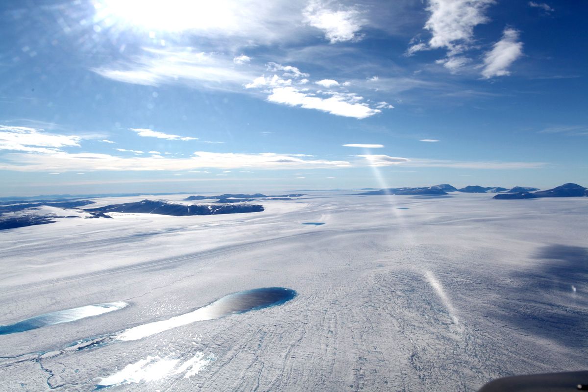 Zachariae Isbrae, in northeast Greenland.Anders A Bjork/The Ohio State University
Researchers have been tracking Greenland’s ice sheet melt by measuring the shrinking mass of the island via satellite. It now seems there was an error in measurement. A new study published in the journal Science Advances finds the ice is melting 7 percent faster than previously thought.
Scientists use satellites to map Earth’s gravity field, gathering information about the distribution of mass around the globe. Earth doesn’t exert gravity equally in all directions. Where there is more mass, satellites detect a stronger gravitational pull.
Using satellite data, scientists can measure various geophysical phenomena, including the melt of the Greenland ice sheet. As ice dissolves, the island loses mass and exerts a weaker gravitational pull—at least that’s the idea.
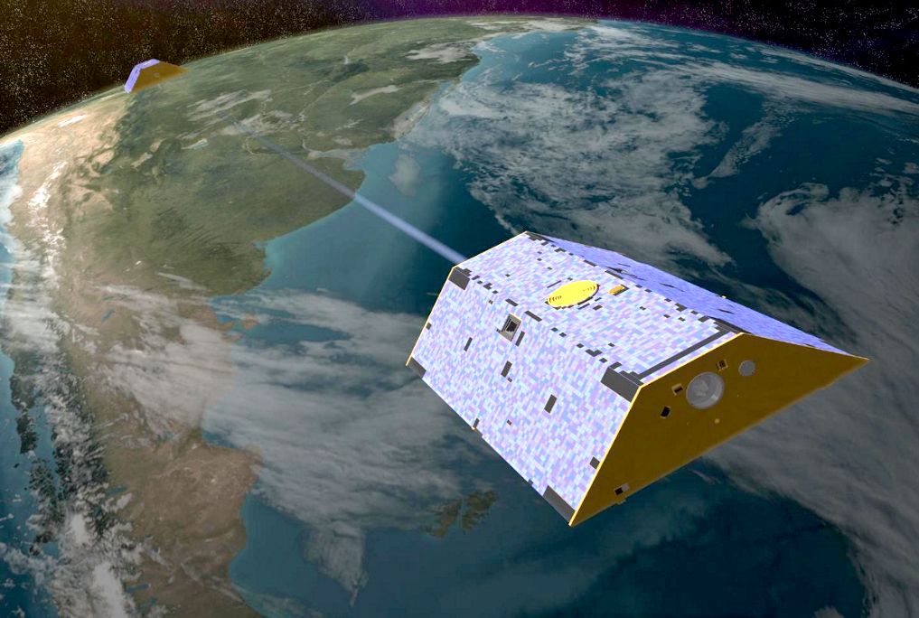 An artist’s rendering of NASA’s Gravity Recovery and Climate Experiment satellites measuring Earth’s gravity field.NASA/JPL-Caltech
In practice, it’s a little more complicated. Satellites can only detect a change in mass. They can’t determine how much of that mass is ice, how much is land and how much is mantle ebbing and flowing beneath the Earths’ crust.
“[The system] cannot tell the difference between ice mass and rock mass,” said study co-author Michael Bevis, professor of Earth sciences at Ohio State. “So, inferring the ice mass change from the total mass change requires a model of all the mass flows within the Earth.”
Here’s where this gets interesting.
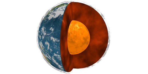 A cross-section of Earth. The Earth’s crust rests on a thick layer of mantle. Below that lies the Earth’s solid core.NASA/JPL, Université Paris Diderot and the Institut de Physique du Globe de Paris
Tectonic plates are always moving. The plate under North America—including Greenland—has been traveling northwest for millions of years. Around 40 million years ago, Greenland slid over an extra hot column of partially molten rock. This hot spot softened up the crust below the island’s east coast. (The hot spot now rests beneath Iceland, where it is driving all manner of volcanic activity—warming hot springs and fueling the country’s geothermal power plants.)
The softening of Earth’s crust beneath Greenland had consequences during the last ice age, when Greenland’s ice sheet was significantly thicker. The weight of all that ice caused the island to sink into the supple crust below. When the ice age passed and the ice began to melt, the island rebounded. Mantle flowed in beneath Greenland, causing the land to rise again. It’s still rising today.
You can imagine how this would interfere with satellite readings. The loss of ice is weakening Greenland’s gravitational pull. At the same time, the accumulation of mantle is strengthening its gravitational pull.
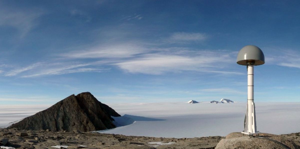 One of dozens of GPS units researchers used to measure the rise of land.Dana J. Caccamise II/The Ohio State University
Scientists previously accounted for the flow of mantle, but they underestimated its effect. The study’s authors used GPS technology to measure the rise of land at various points along Greenland’s east coast. They discovered that mantle is gathering beneath Greenland more quickly than they had realized.
What this means is that scientists have been underestimating ice loss by 20 billion metric tons per year. More of the melting is occurring along Greenland’s east coast than previously thought.
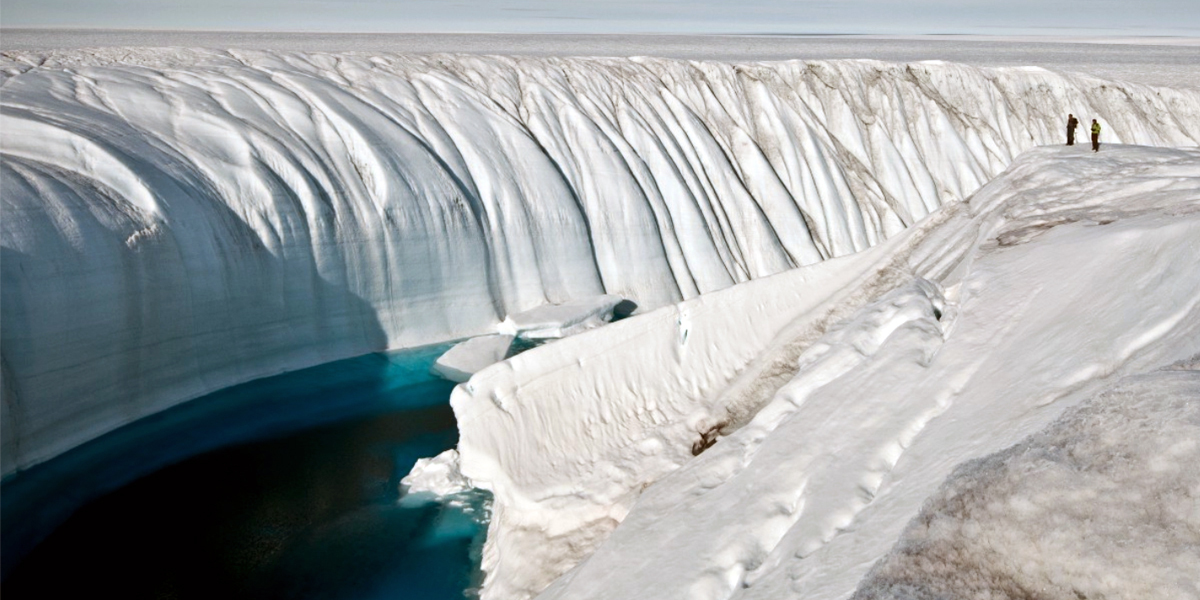
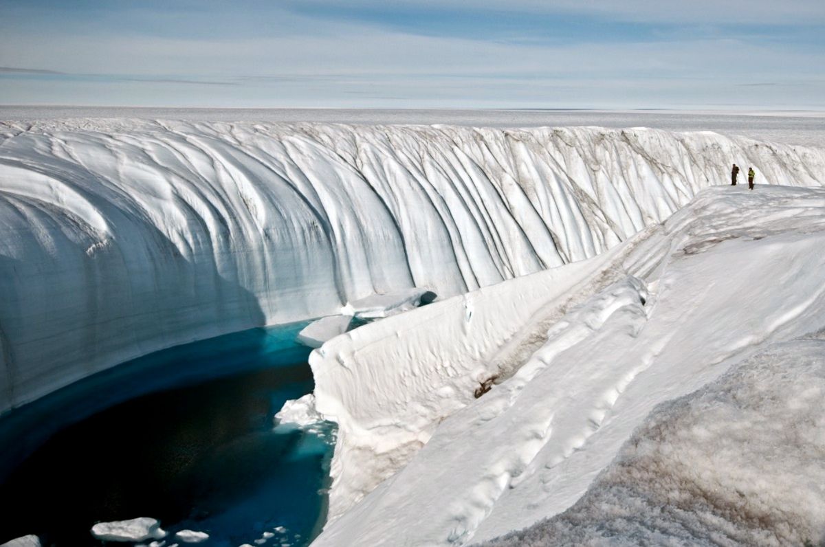 Water overflow from a lake formed from melted ice carved this 60-foot canyon into the Greenland ice sheet.Ian Joughin, University of Washington
“By refining the spatial pattern of mass loss in the world’s second largest—and most unstable—ice sheet, and learning how that pattern has evolved, we are steadily increasing our understanding of ice-loss processes, which will lead to better-informed projections of sea-level rise,” said Bevis.
The study has implications for Antarctica—the 800-pound gorilla of global sea-level rise. Scientist will need to deploy more GPS measurement stations at Earth’s southern pole to accurately measure the flow of mantle beneath the continent and get a better reading of Antarctic ice melt.
Better data will allow scientists to predict future sea-level rise more accurately. That could prove crucial for coastal cities preparing for the impacts of climate change.