
 568k
568k  233k
233k  41k
41k  Subscribe
White Oak Canyon
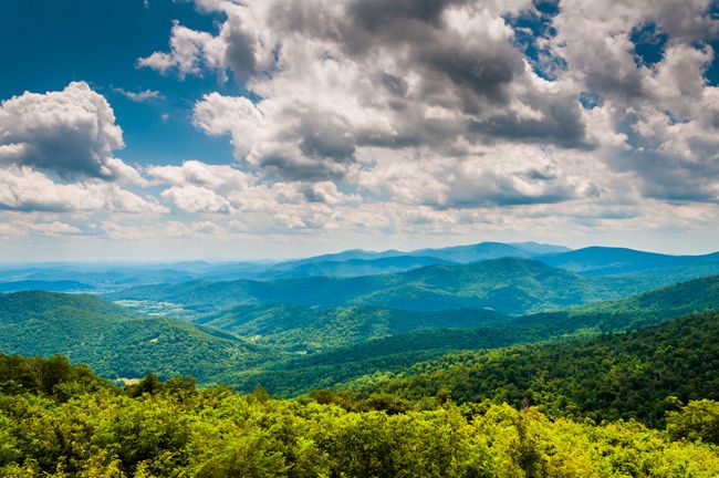
This 4.8-mile hike in Virginia’s Shenandoah National Park is a standout because you’ll cross wooden footbridges over emerald pools and see six major waterfalls. While Shenandoah’s high alpine trails can only be tackled a few months out of the year, this trail is open and accessible all year. Spring brings wildflowers to the open meadows. The trees provide ample shade to avoid the heat of summer. The fall foliage is not to be missed. And there’s a certain beautiful serenity to a winter walk.
The Narrows
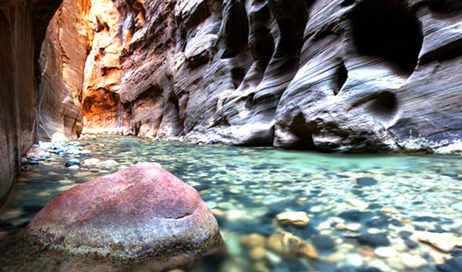
The Narrows is the narrowest part of the canyon walls in Zion National Park. The Virgin River cuts through the canyon, creating walls up to 1,000 feet tall and sometimes just twenty feet wide. A hike in the narrows involves actually walking in the river. Depending on the river flow, the water reaches from ankle level to waste deep or more. Hikers take in incredible views of the canyon walls as they trek through the river.
The Lost Coast Trail
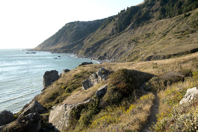
The Lost Coast is the portion of California’s north coast that was spared the development that came with building State Route 1 right along the coast in the southern portion of California. The steepness of the coastal mountains and the density of coastal forests made it difficult to build the highway right on the coast, so this part of California has remained more rugged and remote. As a result, the Lost Coast has maintained more of its natural beauty. The Lost Coast Trail is a 24-mile hike starting at Mattole and ending at Black Sands Beach. You will hike through rocky tidal pools, watch sea lions sunbathing on the beach and explore abandoned lighthouses. The hike, which takes about three days, is impassible at times because of the tides, so don’t forget a tide chart.
Mount Mitchell Trail
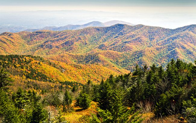
At nearly 7,000 feet, Mount Mitchell near Asheville, North Carolina is the highest peak east of the Mississippi and it’s not to be missed. It’s an 11-mile hike with a 3,600-foot elevation gain, making it one of the toughest climbs in the area. The views from the summit are spectacular in any season. The summit is accessible to vehicles, so if you don’t want to share your summit views with a bunch of people, pick a bad weather day or a day when the road is closed.
Half Dome
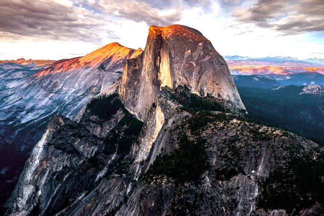
The 14 to 16 mile round trip hike is not for the faint of heart. You will be gaining elevation (4,800 feet in total) for most of your hike. But it’s well worth the effort. Along the way, you’ll take in views of Vernal and Nevada Falls, Liberty Cap, Half Dome and views of Yosemite Valley and the High Sierra. It takes most hikers 10 to 12 hours to complete, so an early start is a must. The most famous part of the hike is the metal cables, which make the last 400 feet of the ascent possible. Permits are required and are distributed by a lottery.
YOU MIGHT ALSO LIKE
10 Spectacular Hikes to Consider for Your Next Outdoor Adventure