
 568k
568k  233k
233k  41k
41k  Subscribe
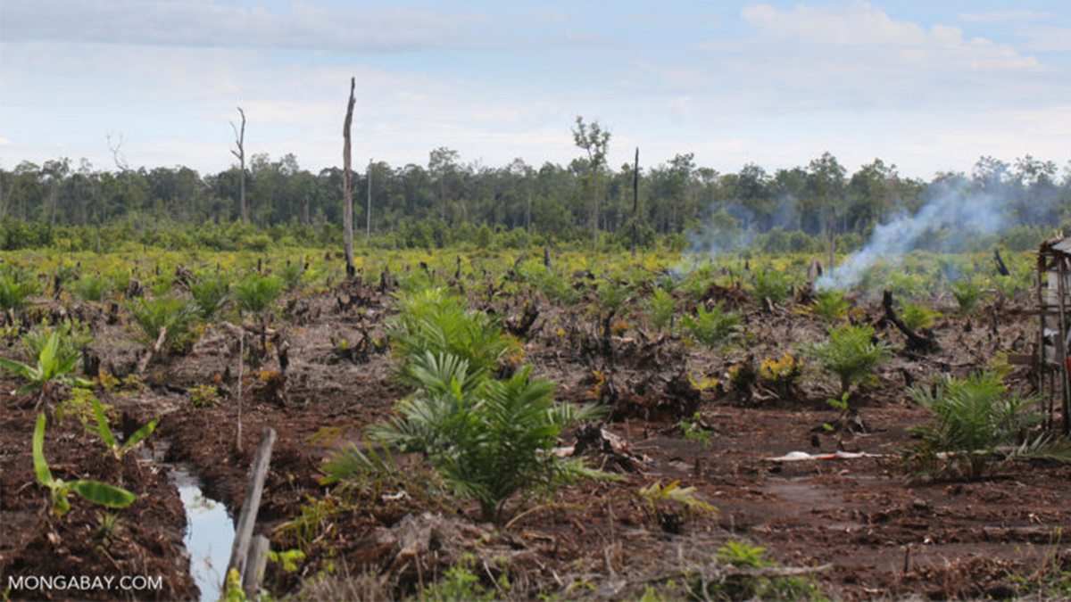
Newly established oil palm plantation in Central Kalimantan, Indonesia. Rhett A. Butler / Mongabay
By Hans Nicholas Jong
Indonesia’s president has made permanent a temporary moratorium on forest-clearing permits for plantations and logging.
It’s a policy the government says has proven effective in curtailing deforestation, but whose apparent gains have been criticized by environmental activists as mere “propaganda.”
Environment and Forestry Minister Siti Nurbaya Bakar said President Joko Widodo had signed the permanent extension of the moratorium on Aug. 5. The moratorium prohibits the conversion of primary natural forests and peatlands for oil palm, pulpwood and logging concessions, and was introduced in 2011 by then-president Susilo Bambang Yudhoyono as part of wider efforts to reduce greenhouse gas emissions from deforestation.
The moratorium was initially slated to run for two years, but was extended three times since then, with the latest extension signed in 2017 and expiring on July 17 this year.
“This is a very good and positive thing,” Siti said in a statement, adding that it was the latest concrete example of Widodo’s commitment to environmental protection.
But the moratorium hasn’t helped slow the loss of primary forests, say activists. If anything, they say, the deforestation rate has actually increased within areas that qualify for the moratorium.
Forest Loss and Fires
The rate of deforestation in areas covered by the licensing ban between 2011 and 2018, the period during which the moratorium has been in force, is down 38 percent from the seven years prior, according to data from the Ministry of Environment and Forestry.
But analysis of satellite imagery by Greenpeace shows that deforestation rates increased in those areas after 2011. The NGO recorded 12,000 square kilometers (4,630 square miles) of forest loss within the moratorium areas in the seven years after the ban was implemented. This corresponds to an average annual rate of deforestation of 1,370 square kilometers (530 square miles) — higher than the average 970 square kilometers (375 square miles) per year in the seven years before 2011.
Greenpeace said the government’s data were neither consistent nor available in a format that can be processed using geographic information system (GIS) software. Instead, it relied on data from the University of Maryland, which has been tracking tropical deforestation rates around the world since 2001.
“The Indonesia forests moratorium is a good example of government propaganda on forest conservation,” said Kiki Taufik, the head of Greenpeace’s Southeast Asia forests campaign. “It sounds impressive but doesn’t deliver real change on the ground.”
The moratorium has also had a questionable impact on preventing fires in the areas it’s meant to cover, Greenpeace found in its analysis of government data. Nearly a third of the 34,000 square kilometers (13,100 square miles) of forests and land burned between 2015 and 2018 were in moratorium areas, mainly in the provinces of Central Kalimantan, Papua, South Sumatra and Riau.
During the particularly intense fire season of 2015, 7,000 of the 26,000 square kilometers (2,700 out of 10,000 square miles) of burned areas were in moratorium areas. So far this year, with the fire season shaping up to be the worst since 2015, a quarter of the hotspots are in moratorium areas, Greenpeace found.
Another study, published in 2015 at the peer-reviewed journal Proceedings of the National Academy of Sciences of the United States of America (PNAS), also measured the effectiveness of the moratorium in reducing deforestation and emissions from it by evaluating deforestation and emission rates circa 2011 against rates over the period 2000 to 2010.
According to the study, less than 3 percent of deforestation and less than 7 percent of emissions would have been avoided had the moratorium been implemented in 2000.
“For Indonesia to have achieved its target of reducing emissions by 26 percent [by 2020], the geographic scope of the moratorium would have had to expand beyond new concessions to also include existing concessions and address deforestation outside of concessions and protected areas,” the study concluded.
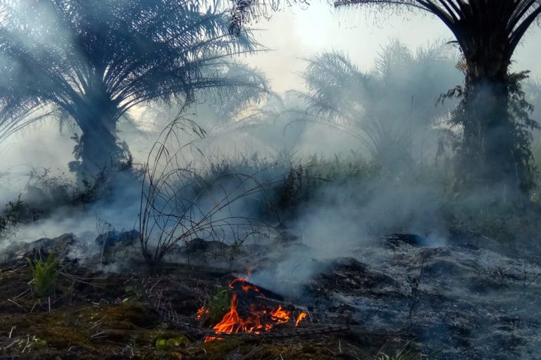
Fires engulf a palm oil plantation in Rokan Hilir district, Riau, Indonesia.
Zamzami / Mongabay Indonesia
Lingering Loopholes
Much of these problems are down to loopholes in the moratorium, activists say.
The policy explicitly prohibits the issuance of new plantation and logging permits for carbon-rich primary forests — but not for secondary forests, defined under Indonesian law as those that have previously been logged to any extent.
As a result, some parties are deliberately clearing areas of primary forest within moratorium zones for the express purpose of degrading them. Once that happens, these areas are recognized as secondary forest, and thus fall out of the scope of the moratorium, says Zenzi Suhadi, the head of advocacy at the Indonesian Forum for the Environment (Walhi).
“The moratorium only applies to primary natural forests, but once they’re degraded and became secondary forests, permits can be issued there,” Zenzi said. “This is what makes natural forests keep losing their cover.”
He said the government should include secondary forests in the licensing ban. But the government has previously rejected the proposal, saying that doing so would deprive local and indigenous communities of their right to manage the forests on which they depend.
There’s also the problem of the moratorium’s shape-shifting nature, with swaths of forest omitted over the years.
Greenpeace’s analysis has found that 45,000 square kilometers (17,400 square miles) of forests and peatlands have been removed from the map since 2011. Of these, 16,000 square kilometers (6,200 square miles), or more than a third, have since been licensed out for various commercial uses.
Greenpeace’s Kiki attributed this to a requirement that the government revise the moratorium map every six months — what he said amounted to a major loophole that companies could exploit to have areas they’re interested in removed from the map.
“Deforestation and forest fires have continued inside moratorium areas, and boundary maps get regularly redrawn to remove forest or peat areas that are of interest to plantation companies,” he said. “Making it permanent doesn’t fix its fundamental weaknesses and won’t stop forest and peatland degradation in Indonesia.”
Zenzi of Walhi said he found a similar pattern when analyzing the number of permits issued after the moratorium was enacted in 2011. A huge number of permits were granted that year and in subsequent years under the Yudhoyono administration, he said.
The size of permits issued under Yudhoyono, from 2011 to 2014, while the moratorium was in force, amounted to 164,000 square kilometers (63,300 square miles), an area nearly the size of Florida. Under Widodo, who took office in 2014, Zenzi said, the government issued permits for 17,000 square kilometers (6,600 square miles) of land.
“The moratorium was established during Yudhoyono’s era, but at the same time, he also issued many permits,” he said. “So what’s the deal with this moratorium? Is it really designed to curb deforestation and emissions, or is it aimed to greenwash the issuance of permits [for exploitation] that’s already happening?”
In all, the total area subject to the moratorium has shrunk by 30,000 square kilometers (11,600 square miles), according to Muhammad Teguh Surya, the executive director of the NGO Yayasan Madani Berkelanjutan.
“But there’s no explanation on the locations of the omitted areas and for what or whose interests” they were omitted, he said.
As long as the moratorium map continues to be subject to revision, Zenzi said, the problem would persist.
“It shows that this moratorium doesn’t prevent people’s desires to get permits for natural forests in Indonesia, because the map can be adjusted,” he said.
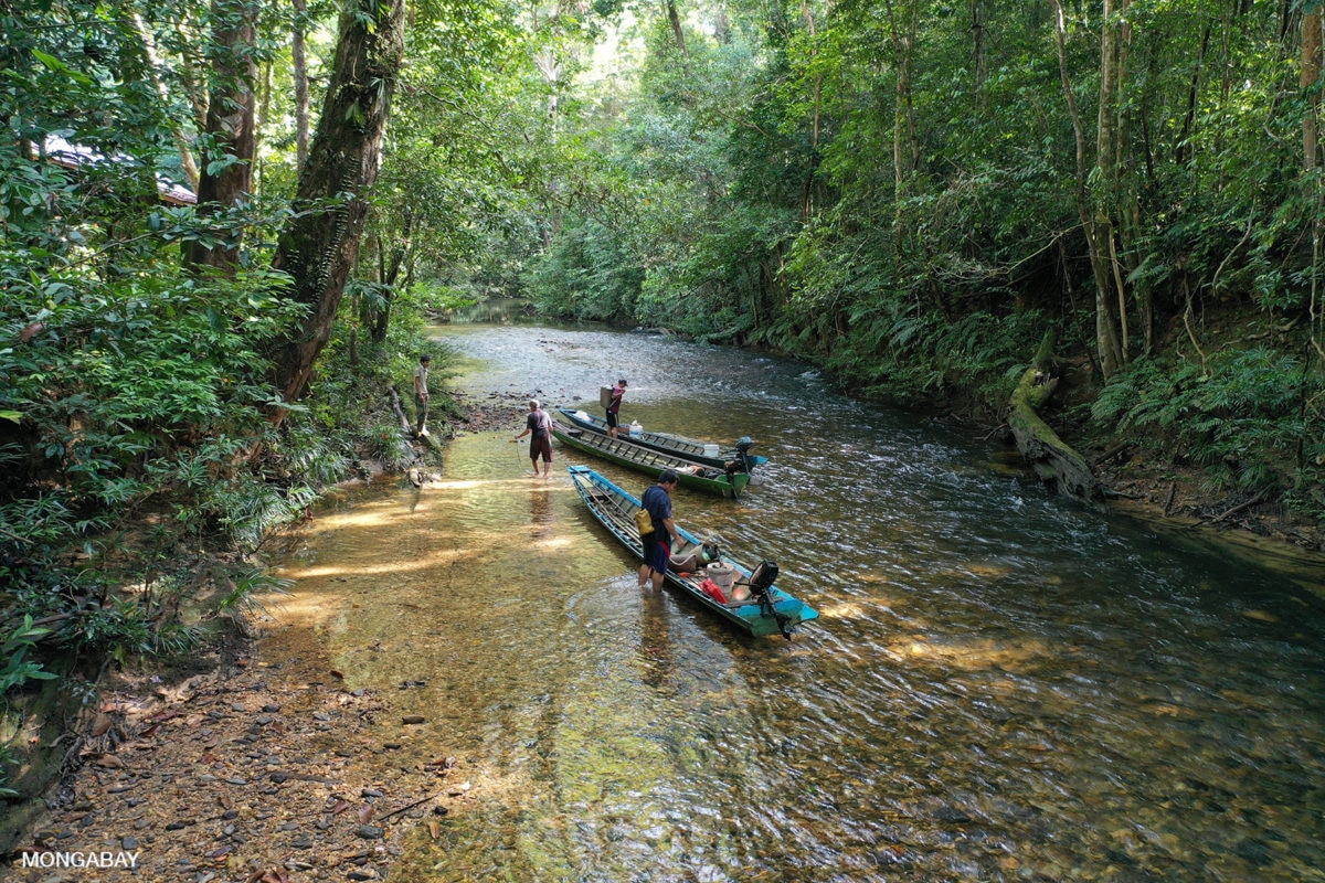
Iban dugout canoes on the Utik river in Sungai Utik’s customary forest in West Kalimantan, Indonesian Borneo.
Rhett A. Butler / Mongabay
Local Lobbying
While the moratorium is administered by the national government, the revision of the map happens at the local level. Businesses typically lobby local authorities to revise their zoning plans for areas that have been identified as falling inside the moratorium boundary. The pliant local officials then rezone these areas as being for “other-use” purposes, known as APL in Indonesian, where mining and oil palm cultivation are permitted.
The local government will then notify the forestry ministry of this change, and once approved, the area in question is dropped from the moratorium map.
Zenzi said this was a common practice, particularly in the run-up to election, when local government leaders are seeking funding for re-election. A textbook example of this is the case of Annas Maamun, the former governor of Riau province in Sumatra, one of the most extensively deforested provinces in Indonesia, and the heartland of the country’s palm oil industry.
Annas was arrested in 2014 for taking 2 billion rupiah in bribes (about 0,000 at the time) from a palm oil businessman to rezone swaths of forest in the province as APL areas. The move was meant to legitimize the plantations already operating there.
In 2015, a court convicted Annas of corruption and sentenced him to six years in prison. An appeals court in 2016 upheld the conviction and added another year to his sentence.
Zenzi said this particular practice cleverly exploited another loophole in the forest moratorium: the fact that it explicitly bans the issuance of new permits, but not the conversion of forest areas into APL areas.
Between 2009 and 2014, local leaders across 22 provinces proposed the conversion, through zoning revisions, of a combined 122,500 square kilometers (47,300 square miles) of forest. Nearly two-thirds of that land has since been converted, leaving the fate of the remaining 44,500 square kilometers (17,200 square miles) of forest hanging in the balance.
“What I’m very worried about is this year, because next year there will be concurrent local elections in some provinces and districts, and many incumbents are running again,” Zenzi said. “If we look back at 2014, many incumbent politicians proposed for forest areas to be released [from the forestry ministry].”
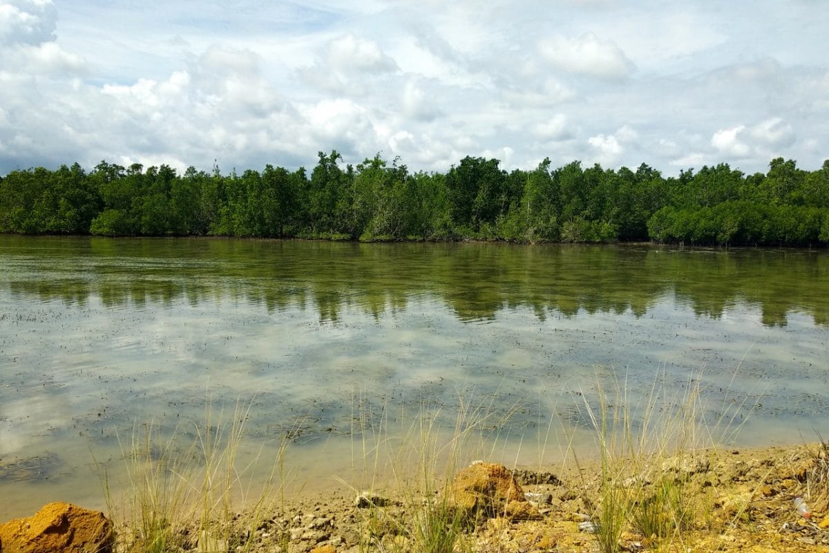
Mangrove forests on Bungkutoko Island in Southeast Sulawesi province, Indonesia.
Kamarudin for Mongabay Indonesia
Uncovered Forests
Another shortcoming of the moratorium is that large tracts of primary forest aren’t covered by it and are thus vulnerable to exploitation, according to Greenpeace.
It found 333,000 square kilometers (128,600 square miles) of primary forest and more than 65,000 square kilometers (25,100 square miles) of peatland, some of it forested, open to development.
Zenzi attributed this to yet another loophole in the moratorium, which doesn’t prohibit the issuance of new permits that have already been applied for or processed — especially if what’s known as a principal permit was issued prior to the moratorium coming into effect.
A principal permit effectively marks the start of a company’s formal application process for a forest conversion permit.
“In Papua, there’s a lot of APL areas that are still natural forests. There’s a possibility that they’re not included in the moratorium areas because there are already principal permits there,” Zenzi said. “This is a weakness of the moratorium because it doesn’t stop the process of permit issuance if a principal permit has been issued.”
Teguh of the NGO Madani also questioned the future of forests outside the moratorium map. The moratorium currently covers 660,000 square kilometers (255,000 square miles) out of the 894,000 square kilometers (345,000 square miles) of natural forests in the country, according to 2018 data from the forestry ministry.
“Does it mean that the forests outside those [protected under the moratorium] are ready to be converted?” Teguh said.
At the same time the government also plans to expand the size of acacia plantations (for pulpwood to make paper products) by 50,000 square kilometers (19,300 square miles) by 2030, according to the forestry ministry.
Teguh said such a plan contradicted the moratorium and if left unaddressed would make the situation “even more confusing.” It could, he said, “become a loophole to deforest and threaten the achievement of our climate commitment.”

A birdwatching guide in West Papua, Indonesia. Tourism can bring money into local communities and give an incentive to conservation.
Rhett A. Butler / Mongabay
Oil Palm Moratorium
The moratorium could, in theory, be shored up by a newer prohibition on issuing licenses for new oil palm plantations. The latter moratorium, issued last September by President Widodo, also bans the clearing of natural forests even if they’ve been zoned as APL areas.
But that moratorium applies only to the palm oil industry and will be in force a maximum of three years.
And even after the moratorium went into force, the forestry ministry was still granting forest conversion decrees permits without consequences, according to Zenzi. He cited the case of one such decree, issued in May, to convert a forest area spanning 913 square kilometers (353 square miles) in South Sulawesi province into APL.
Zenzi said the conversion had been requested by the governor of South Sulawesi as part of a proposal to convert 2,038 square kilometers (787 square miles) of forest areas into APL.
While the decree appears to contravene the oil palm moratorium, the forestry ministry can justify its decision by saying that the decree is only for conversion of forest to APL area. “Whether those areas will then become oil palm plantations or not are up to the local leaders,” Zenzi said.
In Indonesia, the overwhelming use of APL land is for oil palm cultivation.
Zenzi said he had identified another proposal, by the government of Bengkulu province in Sumatra, to convert 500 square kilometers (193 square miles) of forest area into APL. He warned of an influx of similar proposals to the forestry ministry ahead of next year’s local elections, and said the issue needed to be monitored closely.
“The window to reduce forest areas is still wide open if local heads propose areas under the moratorium policy to be converted,” he said.
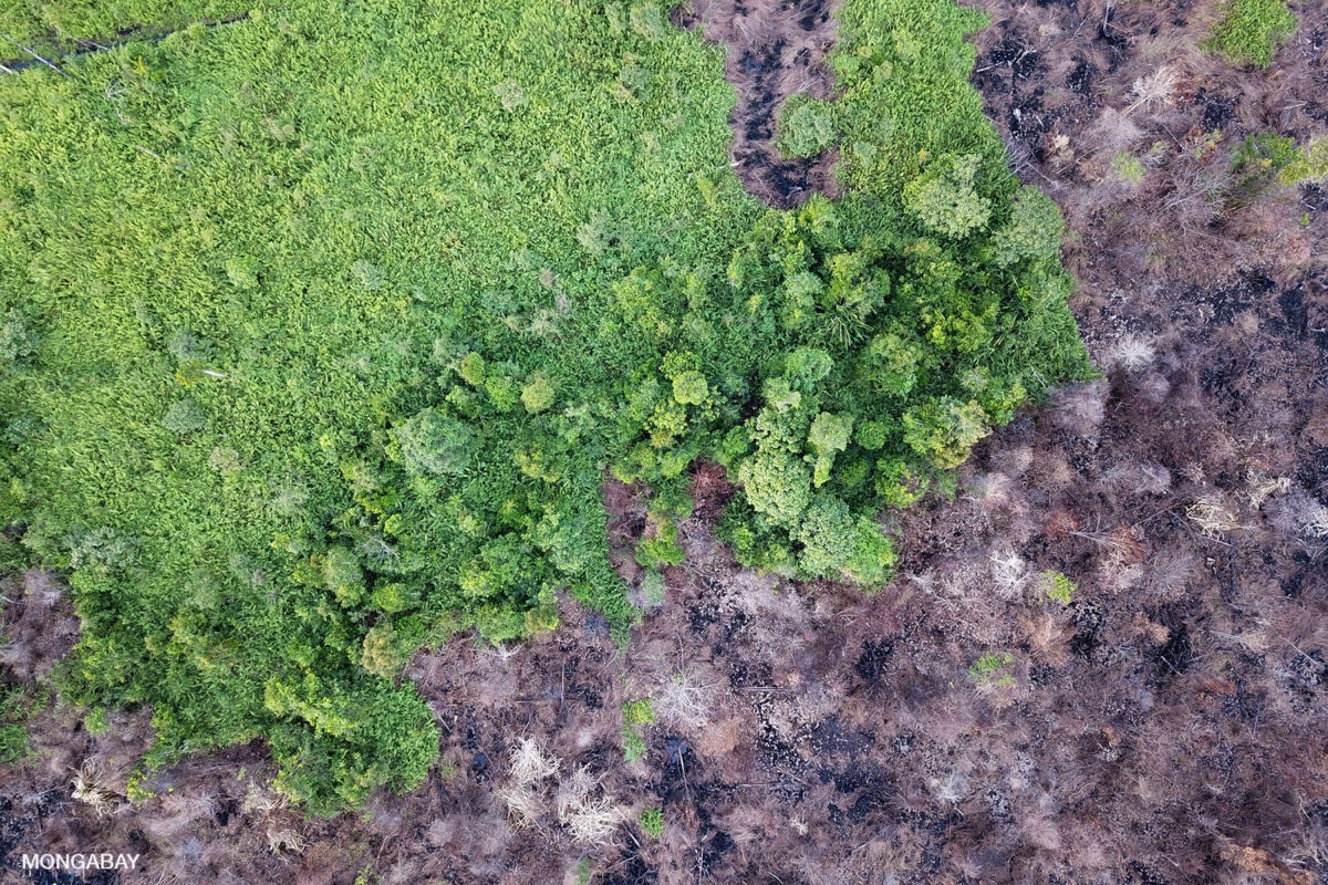
Drained, cleared and burned peat forest in Indonesian Borneo.
Rhett A. Butler / Mongabay
Government Response
The government has acknowledged the criticisms about the forest and peatland moratorium, but disputes some of them.
Belinda Arunarwati Margono, the director of forest resources monitoring at the forestry ministry and a former researcher at the University of Maryland, acknowledged separately that forest fires were still happening inside moratorium areas. However, she said they were contained mostly to areas without tree cover, such as peatlands, savannas and shrubland.
She also said the ministry had identified a similar size of moratorium area that was burned during the 2015 fires, but that only 3 percent of those fires had occurred in forested space, with the rest occurring in non-forested areas.
Similarly, she said that of the fires inside moratorium areas this year, only 0.8 percent occurred in natural forest areas.
“So from here we can see the effectiveness of the moratorium on forest fires,” Belinda said. “Because the size of forested areas burned keeps getting smaller, and even now declined to less than 1 percent of the total areas burned.”
Separately, Abetnego Tarigan, an environmental adviser in the office of the president’s chief of staff, agreed that local governments, with the power to determine the boundaries of moratorium areas, played a crucial role in ensuring the policy was implemented properly.
“The role of the Ministry of Home Affairs is very important in making sure the local governments truly comprehend and carry out this presidential instruction” on the licensing ban, he said. “The local governments are the ones who spearhead the implementation of the presidential instruction.”
Abetnego also called for a monitoring system that’s more open and publicly accessible so that the civil society can help monitoring areas that were protected under the policy.
But Teguh from Madani said it was precisely the opacity and lack of a public monitoring system that allowed for the exploitation of the moratorium’s loopholes.
“And the mechanism [of revising the moratorium map] isn’t clear or open for the public to participate in,” he added.
Reposted with permission from our media associate Mongabay.