568k
568k  233k
233k  41k
41k  Subscribe
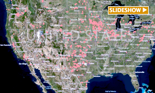
As wind energy advocates fight for the renewal of a critical, expired wind energy tax credit and hope for the development of an offshore industry, the U.S. Geological Survey (USGS) has taken note of the onshore wind turbines installed around the country.
All 47,000 of them.
That’s the USGS’ installation estimate for the country as of July 2013. To illustrate it, the federal agency this week released a highly interactive map that allows you zoom in and out of all 50 states to view data on each turbine.
Here’s a look at the map’s features, through the lens of the American Wind Energy Association’s top five states for utility scale wind turbines.
[slideshow_deploy id=’351616′]
“The purpose of this project is to provide a publicly available, spatially referenced, national dataset of onshore wind turbine locations and their corresponding facility information and turbine technical specifications,” according to the USGS.
The map’s tools allow you to enter a state or site name, instructing the map to zoom in by command. Once you zoom in on a certain project, you can learn about its capacity, height, blade length, the date it went online and more. You can also toggle between satellite and thematic views.
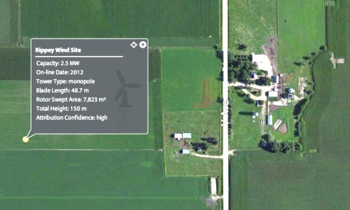
The USGS compiled the map using information from the Federal Aviation Administration Digital Obstacle File, along with other manually digitized turbine locations. The USGS verified turbine positions using visual interpretation from high-resolution aerial imagery.
Visit EcoWatch’s RENEWABLES page for more related news on this topic.