Will Hurricane Florence Flood North Carolina Factory Farms and Manure Pits?

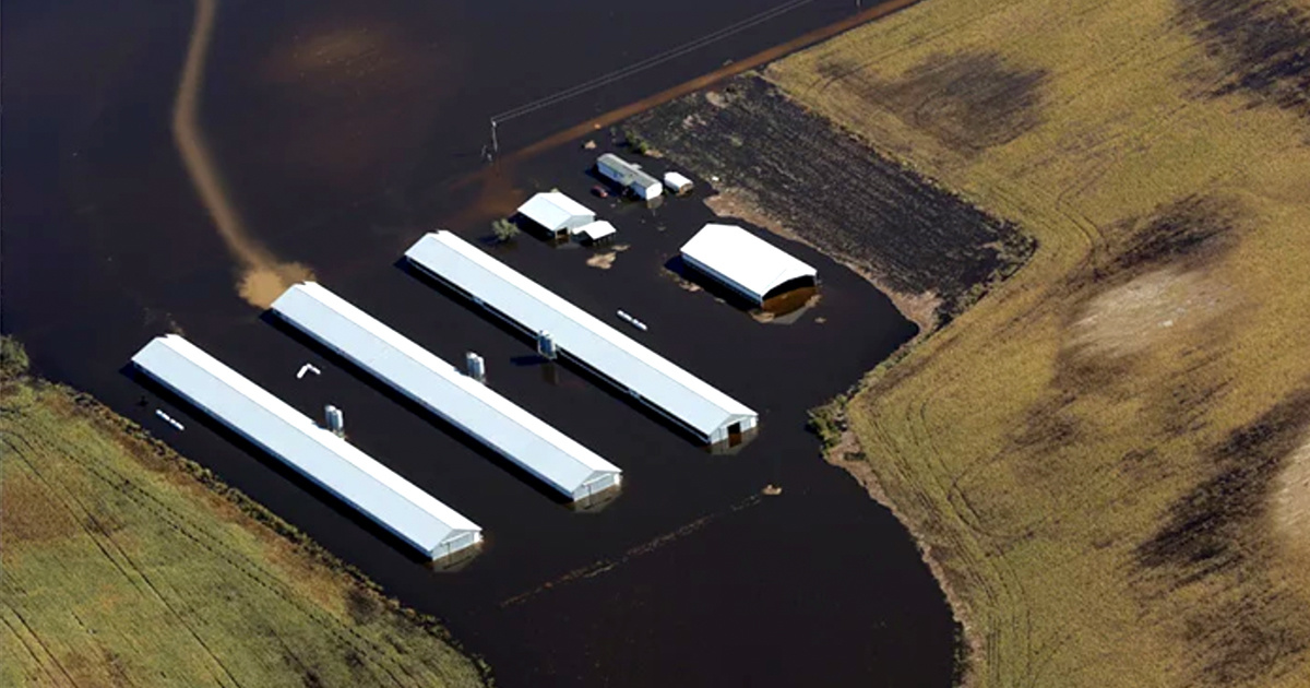
When Hurricane Matthew hit North Carolina in 2016, it flooded more than 140 feces-strewn industrial-scale swine and poultry barns, more than a dozen open pits brimming with liquid hog waste and thousands of acres of manure-saturated fields. As Hurricane Florence—far bigger than Matthew—bears down on the state, Environmental Working Group (EWG) and Waterkeeper Alliance are prepared to again assess the impact on North Carolina’s concentrated animal feeding operations or CAFOs.
Florence is poised to be the strongest hurricane to hit the Carolinas in 30 years. Its torrential rains are likely to drench the swine and poultry barns and manure pits that are scattered statewide, but heavily concentrated in the lowlands of southeastern North Carolina.
When floodwaters reach CAFO barns, manure pits or fields where liquid waste is sprayed as fertilizer, nearby lakes, rivers and streams may become contaminated with a devil’s brew of pollutants that can be extremely hazardous to human health and the environment. The contaminated water may contain deadly pathogens, such as E. coli or salmonella, which could make drinking water and recreational waters dangerous.
North Carolina’s hog and other CAFOs produce almost 10 billion gallons of fecal waste a year—enough to fill more than 15,000 Olympic-size swimming pools. Within the 100-year floodplain of 47 coastal counties, 62 CAFOs house more than 235,000 hogs and 30 other operations house more than 1.8 million chickens. There are 166 open-air waste pits directly within the 100-year floodplain, and another 366 within 100 feet of the floodplain.
In November 2016, EWG and Waterkeeper used aerial photos, satellite imagery and geospatial mapping to provide the first publicly available, detailed analysis of Hurricane Matthew’s impact on CAFOs along the Neuse, Black and Cape Fear rivers. The organizations will conduct a similar assessment in the days after Florence passes.
“Obviously, our first concern is for people directly threatened by the storm,” said Soren Rundquist, EWG’s director of spatial analysis. “But by mapping the impact on CAFOs, we want to drive home the recklessness of placing densely concentrated industrial-scale livestock operations in a low-lying area regularly deluged by tropical storms.”

 233k
233k  41k
41k  Subscribe