Colorado Rivers Illustrate Realities of Extreme Weather Activated by Climate Change

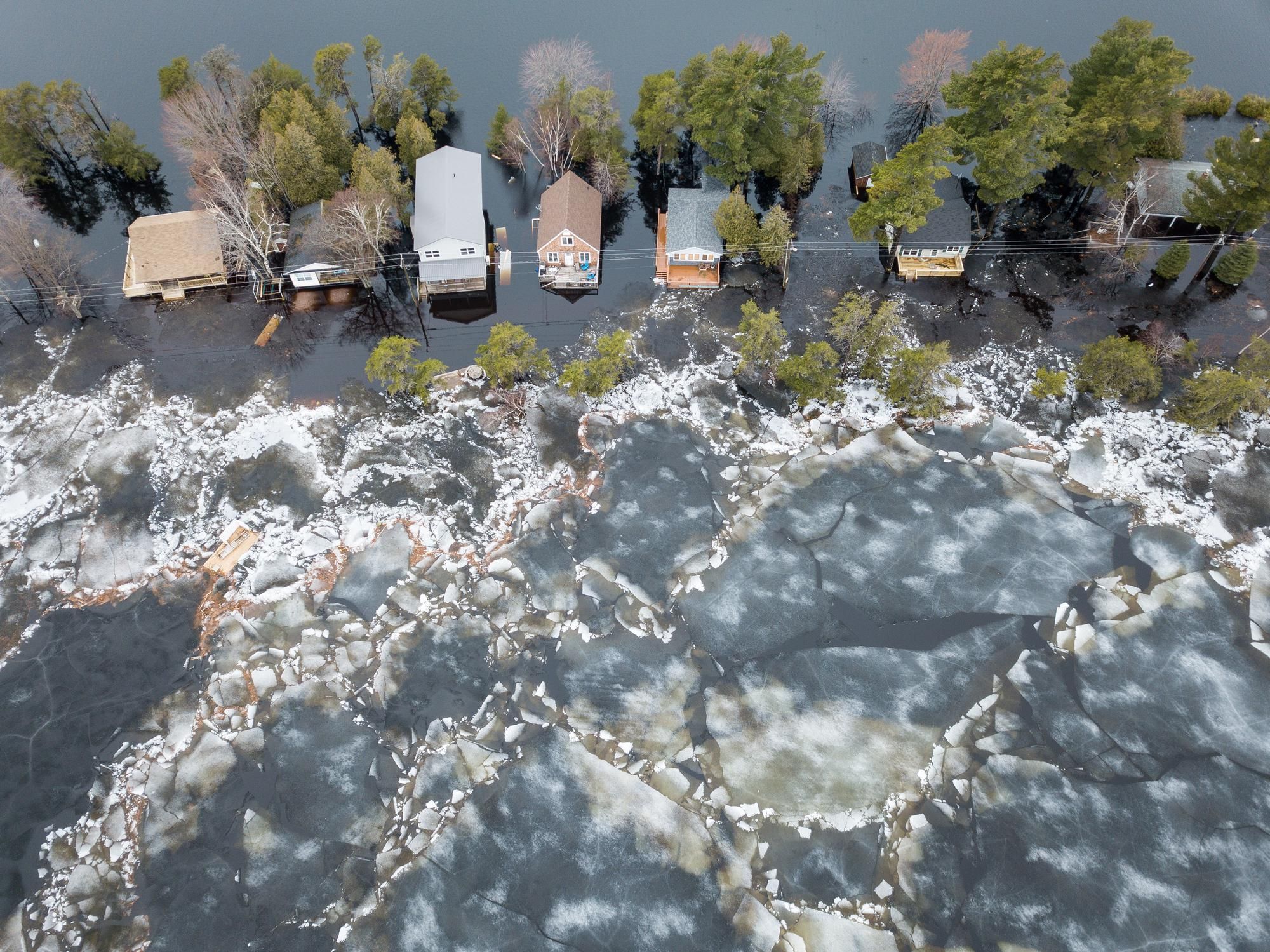
The river raced. I was standing near the bridge on College Avenue over the Cache la Poudre River in Fort Collins, CO. Due to the torrential rainstorms, the river had peaked about six hours earlier in the middle of the night, but it was still flowing about 100 times bigger than it usually does in September. A huge tree raged along in the floodwaters, smacked up against the bridge with a cracking sound, and then disappeared under the bridge. Spectators oohed and aahed–a couple dozen of us were watching, mostly because almost everyone in this town of 160,000 people had nothing else to do. The river, which encircles most of the roads leading out of town, rose up and closed down every bridge. We watched and stared and took pictures.
The river spoke in ways I never could.
I am an environmental activist. I became a working environmental activist because of this river, the Cache la Poudre. When I moved to Fort Collins 13 years ago with two small children, we bought a house just two blocks away from the river and played and played in the rocks and sand and water along the river, a wonderful activity for kids and for dads too. And so when I heard about a proposal to build a big dam that would drain and destroy the river, my adult friends and I stood up and started taking action. Activism is like that–you dip in your foot, and then your whole body is soon engulfed, and you become activated to protect and defend what you love.
As a part of my work as a river activist, two years ago I was appointed to a Floodplain Working Group for the City of Fort Collins, on which I tried to encourage a group of developers and business people to take flooding seriously and to not build homes and businesses in the Cache la Poudre River's 100-year floodplain. I was not successful, and was voted down 12-1 repeatedly in these meetings. And it got ugly–I was called derogatory names and funders quit funding our organization because I was trying to protect human life and property and protect the river itself. I was “standing in the way of progress." And then the developers started browbeating the City Council, threatening their re-elections. A majority of the Council caved in, including my pathetic City Councilman who I regret supporting and donating $75 for his campaign, leaving Fort Collins with very weak floodplain regulations. I spoke up in those meetings and to the City Council, my passion and intensity rising, as best I could, but they didn't listen.
On that floodplain group, I learned a lot about floods. A “50-year" flood is of moderate size that has a one-in-fifty statistical chance of occurring in any one year; a 100-year flood is much bigger and way more damaging; a 500-year flood can wipe away low-lying towns and cleave a landscape like a butcher's knife. Along the northern Front Range of Colorado–from Boulder to Longmont to Loveland to Fort Collins–this September flood of 2013 ranged between a 50-year and a 500-year flood event depending on which creek or river it raged through.
If you were a betting person, you would not have predicted a massive flood in 2013 in Colorado, but with climate change and the new extreme weather it brings, all bets are off. Along the Boulder to Fort Collins mountain landscape, we've had three consecutive years of near-record extreme weather events–near record high snowpack in 2011, near record heat/drought/forest fires in 2012, and now near record high rainfall in 2013.
The forest fires last year in the mountains were huge and damaging in Boulder County but especially the High Park Fire west of Fort Collins in Larimer County. And then this year, the flooding and fires all mixed into a maddening fury when the torrential rain swept over the fire-burned areas. Because the fires killed the trees and charred the soil, the water raced off the landscape carrying with it trees, rocks, mud and coal-black soot which turned the Cache la Poudre River into a black debris-filled torrent. Over the last 12 months, every time it rains the Cache la Poudre River turns black; in this September 2013 flood, the river was a flooding black tornado.
The impacts of the drought, snow, fires and rain are devastating, but the role that politicians play in enabling this chaos is maddeningly worse. As just one example, our Governor, John Hickenlooper (D-CO), has been all over the board on his statements about climate change. He's a former oilman and huge supporter of oil and gas who brags about his oily background and got national media attention when he sat in front of a U.S. Senate Subcommittee and told them he drank Halliburton's fracking fluid. Right before he was sworn into office in 2011, he told the New York Times that we should “drill the living daylights out of natural gas" in Colorado, even though natural gas is mostly methane, a greenhouse gas that is an increasingly large contributor to climate change. Those of us in the environmental community who supported him, including me with a personal donation of $1,050 which I wish like hell I could get back now, got snookered. But now the Governor is in an awkward position because he's had to call President Obama twice and ask for federal disaster aid to fight climate-change linked record fires in 2012 and record rain and flooding in 2013. Is the Governor listening yet?
And then there's the oil and gas industry. Every year in Colorado they spend millions of dollars lobbying to make sure that every proposed new regulation is defeated. In Colorado this industry completely controls the state government, donating vast sums of money to the Governor, state legislators and lobbying at the federal, state and local level to gut regulations, increase their profits and further pollute the public's health and our environment. There are 50,000 active oil and gas wells are in Colorado, and over 20,000 in Weld County alone, a county that, as this flood story unfolded, also happens to be downstream and in the path of the raging torrent.
I traveled around the northern Front Range of Colorado during the week of flooding, from Fort Collins to Boulder and Denver, and up and down I-25 corridor through the eastern portion of Weld County. As the rain poured down, the Big Thompson River coming out of Estes Park and Rocky Mountain National Park cut its winding canyon highway into pieces and flooded the city of Loveland down below. This highway is the “Gateway to Rocky Mountain National Park" and may take two years to rebuild which will likely devastate businesses in the city of Estes Park as well as the budget of Rocky Mountain National Park. In years past, I've hiked, skied, camped and watched elk in that park. In the fall, the aspen leaves quake, the elk bugle and the crisp clear mountain air makes you feel that life is pure and natural and never more worth living. Perhaps not this year.
The St. Vrain River to the south, also coming out of Rocky Mountain National Park, shredded the canyon road that ran beside it, marooned hundreds people in the mountains who later had to be helicopter-evacuated, partially destroyed the town of Lyons at the bottom of the canyon and flooded Longmont ten miles east on the plains. Lyons is a small and unique community, with a kayak park on the river right in town, a quaint little main street, and bluesy brew pub that attracts national performers (and me occasionally). It will be years before it is all rebuilt and alive again.
Boulder Creek, even farther south, rose up like almost never before and flooded part of downtown Boulder, air-raid sirens screaming in the night attempting to evacuate thousands of people who live along the Creek's floodplain. Some of the smaller mountain creeks west of Boulder experienced a 500-year flood event. In the past, I've rode thousands of miles on a mountain bike in the pristine canyons above Boulder, including near Jamestown where my first child was born and which was damaged severely in this flood. Most of these canyons are now so covered in mud and debris and pieces of homes and lives that they may never fully physically or emotionally recover.
And then there's Weld County, a few miles east and where the landscape flattens out and where all the creeks and rivers from the mountains flowed into the South Platte River and its wide meandering floodplain. The river rose up and spread across the land as if it had always been there, and knew exactly where to go, covering every nook and cranny–homes, oil wells, cattle feedlots, businesses and highways all submerged and be-damned.
Thousands of oil and gas wells in Weld County were submerged as the river rose. Oil and gas tanks floated along in floodwaters, and oil slicks streaked across the liquid landscape. The State government, which is supposed to regulate the industry and protect the public, has very little manpower and money (due to the endless lobbying by the oil and gas industry) to address this problem. The U.S. Environmental Protection Agency engaged, but also has limited manpower and funding. And so the oil and gas industry–which is worth about a trillion dollars–initially did their own inspections and “self-policed." Using helicopters and boats, the industry shut down nearly 2,000 submerged wells and first reported back to the newspapers that "all's well, nothing to see here, keep moving along." But as the oil slicks increased, the industry changed its tune to say, "yeah, there's a problem, but it's small and we're addressing it." A day later when more chaos unfolded, the industry said, "we're not sure of the exact scope of the problem." And then finally, as the waters receded and a dozen spills made headlines, the industry went into a grotesque public relations spin mode and congratulated themselves for their “heroic actions" that contained the disaster. And then, sickly, Gov. Hickenlooper started parroting the industry's talking points.
For years the industry has fought every new regulation, including those for drilling and fracking beside rivers and in floodplains. Will they ever listen?
Back in Fort Collins, the Cache la Poudre River starts on the northern edge of the continental divide in Rocky Mountain National Park, flows 80 miles down an extraordinary canyon as the only National Wild and Scenic River in the state of Colorado, and then spills on to the plains a few miles west of Fort Collins. In this epic rainstorm event, Fort Collins got lucky because the rainfall along the Poudre River was only about half as much as in Boulder County to the south. As the water subsides, the City of Fort Collins government is surveying the damage, and now gets to decide if it's going to build those new commercial buildings in the floodplain. At one time during our Floodplain Working Group process, the proposed regulations allowed commercial buildings in the 100-year floodplain but required that the business create elevated space inside the building, or roof access, so that when a flood comes, stranded workers (or shoppers) could stand on the roof and wait for evacuation. But, believe it or not, the developers and business people howled and ranted and even got that small regulation removed. And the City will also now decide if it should allow a little subdivision along the river within inches of the 100-year floodplain where, believe it or not, a child could step five feet beyond its driveway and get swept away by the black, muddy, debris-filled torrent. The developer has named the subdivision after a historic name given to the Poudre River, “Pateros Creek." Be careful what you ask for, I said. Will they listen now?
I do this work for a living. I represent environmental organizations and I absolutely love what I do. I travel and speak around the state of Colorado and throughout the Southwest U.S. on issues of river protection, clean water, climate change, drought and now flooding. I speak a lot. I write a lot. I send out a lot of press releases and media updates. I blog, post, tweet. I communicate relentlessly. I also race–with my words, work and life. I try to speak loudly and make a difference.
But most people are not listening, especially the developers, the business people, almost all of the politicians, and of course the oil and gas industry whose short-term profit is the only thought on their mind, and then they buy and sell the elections and politicians to make sure that no long-term planning occurs, to make sure that the long arm of government keeps its business out of their business, until of course a human-caused disaster strikes, then who is the first in line to ask for a government subsidy and bailout?
I speak, write, text, tweet, post, blog, lobby and sometimes I yell.
But nothing I could have ever said, with voice, word, Facebook or Twitter–no press release, no blog, no instagram photo–could speak as well as the rivers did in September of 2013.
The rivers rose up and said, “I am river! Hear me roar!"
Will we listen?
On Thursday, April 22, the world will celebrate Earth Day, the largest non-religious holiday on the globe.
This Earth Day falls at a critical turning point. It is the second Earth Day since the start of the coronavirus pandemic and follows a year of devastating climate disasters, such as the wildfires that scorched California and the hurricanes that battered Central America. But the day's organizers still have hope, and they have chosen a theme to match.
"At the heart of Earth Day's 2021 theme, Restore Our Earth, is optimism, a critically needed sentiment in a world ravaged by both climate change and the pandemic," EarthDay.org president Kathleen Rogers told USA TODAY.
Last Earth Day marked the first time that the holiday was celebrated digitally to prevent the spread of COVID-19. This will largely be the case this year as well.
"Most of our Earth Day events will be virtual with the exception of individual and small group cleanups through our 'Great Global Cleanup' program," EarthDay.org's Olivia Altman told USA TODAY.
If you do want to participate in person, you can either host or join a cleanup here. Otherwise, EarthDay.org is streaming three days of climate action beginning tomorrow.
Tuesday, April 20: A Global Youth Summit begins at 2:30 p.m. ET featuring young climate activists like Greta Thunberg and Alexandria Villaseñor. This will be followed at 7 p.m. ET by "We Shall Breathe," a virtual summit organized by the Hip Hop Caucus to look at issues like the climate crisis, pollution and the pandemic through an environmental justice lens.
Wednesday, April 22: Beginning at 7 a.m. ET, Education International will lead the "Teach for the Planet: Global Education Summit." Talks will be offered in multiple languages and across multiple time zones to emphasize the importance of education in fighting the climate crisis.
Thursday, April 22: On the day itself, EarthDay.org will host its second ever Earth Day Live digital event beginning at 12 p.m. ET. This event will feature discussions, performances and workshops focusing on the day's theme of restoring our Earth through natural solutions, technological innovations and new ideas.
The digital event is also designed to parallel a global leaders summit on climate being hosted by the Biden administration.
"EARTHDAY.ORG looks forward to contributing to the success of this historic climate summit and making active progress to Restore Our Earth," Rogers said in a press release. "We must see every country rapidly raise their ambition across all climate issues — and that must include climate education which would lead to a green jobs-ready workforce, a green consumer movement, and an educated and civically engaged citizenry around the world."
EarthDay.org grew out of the first Earth Day in 1970, which drew 20 million U.S. residents to call for greater environmental protections. The movement has been credited with helping to establish the U.S. Environmental Protection Agency and to pass landmark environmental legislation like the Clean Air and Water Acts. It has since gone on to be a banner day for environmental action, such as the signing of the Paris agreement in 2016. More than one billion people in more than 192 countries celebrate Earth Day each year.
This legacy continues. The organization called the scheduling of Biden's summit a "clear acknowledgement of the power of Earth Day."
"This is a critical stepping stone for the U.S. to rejoin the world in combating the climate crisis. In concert with several planned parallel EARTHDAY.ORG events worldwide, Earth Day 2021 will accelerate global action on climate change," EarthDay.org wrote.
NASA is teaming up with an innovative non-profit to hunt for greenhouse gas super-emitters responsible for the climate crisis.
Super-emitters are individual sources such as leaking pipelines, landfills or dairy farms that produce a disproportionate amount of planet-warming emissions, especially methane and carbon dioxide. Carbon Mapper, the non-profit leading the effort, hopes to provide a more targeted guide to reducing emissions by launching special satellites that hunt for sources of climate pollution.
"What we've learned is that decision support systems that focus just at the level of nation states, or countries, are necessary but not sufficient. We really need to get down to the scale of individual facilities, and even individual pieces of equipment, if we're going to have an impact across civil society," Riley Duren, Carbon Mapper CEO and University of Arizona researcher, told BBC News. "Super-emitters are often intermittent but they are also disproportionately responsible for the total emissions. That suggests low-hanging fruit, because if you can identify and fix them you can get a big bang for your buck."
The new project, announced Thursday, is a partnership between multiple entities, including Carbon Mapper, the state of California, NASA's Jet Propulsion Laboratory (JPL) and Planet, a company that designs, builds and launches satellites, according to a press release. The project is being implemented in three stages.
The initial stage, which is already complete, involved the initial engineering development. NASA and Planet will work together in the second stage to build two satellites for a 2023 launch. The third phase will launch an entire constellation of satellites starting in 2025.
The satellites will include an imaging spectrometer built by NASA's JPL, NASA explained in a press release. This is a device that can break down visible light into hundreds of colors, providing a unique signature for chemicals such as methane and carbon dioxide. Most imaging spectrometers currently in orbit have larger pixel sizes, making it difficult to locate emission sources that are not always visible from the ground. However, Carbon Mapper spectrometers will have pixels of around 98 square feet, facilitating more detailed pin-pointing.
"This technology enables researchers to identify, study and quantify the strong gas emission sources," JPL Scientist Charles Miller said in the press release.
Once the data is collected, Carbon Mapper will make it available to industry and government actors via an open data portal to help repair leaks.
"These home-grown satellites are a game-changer," California Governor Gavin Newsom said of the project. "They provide California with a powerful, state-of-the-art tool to help us slash emissions of the super-pollutant methane — within our own borders and around the world. That's exactly the kind of dynamic, forward-thinking solution we need now to address the existential crisis of climate change."
By Jenna McGuire
Commonly used herbicides across the U.S. contain highly toxic undisclosed "inert" ingredients that are lethal to bumblebees, according to a new study published Friday in the Journal of Applied Ecology.
The study reviewed several herbicide products and found that most contained glyphosate, an ingredient best recognized from Roundup products and the most widely used herbicide in the U.S. and worldwide.
While the devastating impacts of glyphosate on bee populations are more broadly recognized, the toxicity levels of inert ingredients are less understood because they are not subjected to the same mandatory testing by the U.S. Environmental Protection Agency (EPA).
"Pesticides are manufactured and sold as formulations that contain a mixture of compounds, including one or more active ingredients and, potentially, many inert ingredients," explained the Center for Food Safety in a statement. "The inert ingredients are added to pesticides to aid in mixing and to enhance the products' ability to stick to plant leaves, among other purposes."
The study found that these inert substances can be highly toxic and even block bees' breathing capacity, essentially causing them to drown. While researchers found that some of the combinations of inert ingredients had no negative impacts on the bees, one of the herbicide formulations killed 96% of the bees within 24 hours.
According to the abstract of the study:
Bees exhibited 94% mortality with Roundup® Ready‐To‐Use® and 30% mortality with Roundup® ProActive®, over 24 hr. Weedol® did not cause significant mortality, demonstrating that the active ingredient, glyphosate, is not the cause of the mortality. The 96% mortality caused by Roundup® No Glyphosate supports this conclusion.
"This important new study exposes a fatal flaw in how pesticide products are regulated here in the U.S.," said Jess Tyler, a staff scientist at the Center for Biological Diversity. "Now the question is, will the Biden administration fix this problem, or will it allow the EPA to continue its past practice of ignoring the real-world harms of pesticides?"
According to the Center for Food Safety, there are currently 1,102 registered formulations that contain the active ingredient glyphosate, each with a proprietary mixture of inert ingredients. In 2017, the group filed a legal petition calling for the EPA to force companies to provide safety data on pesticide formulations that include inert ingredients.
"The EPA must begin requiring tests of every pesticide formulation for bee toxicity, divulge the identity of 'secret' formulation additives so scientists can study them, and prohibit application of Roundup herbicides to flowering plants when bees might be present and killed," said Bill Freese, science director at the Center for Food Safety. "Our legal petition gave the EPA a blueprint for acting on this issue of whole formulations. Now they need to take that blueprint and turn it into action, before it's too late for pollinators."
ATTN @EPA: Undisclosed "inert" ingredients in #pesticide products warrant further scrutiny! ➡️ A new study compared… https://t.co/bdFwXCVHsD— Center 4 Food Safety (@Center 4 Food Safety)1618592343.0
Roundup — also linked to cancer in humans — was originally produced by agrochemical giant Monsanto, which was acquired by the German pharmaceutical and biotech company Bayer in 2018.
The merger of the two companies was condemned by environmentalists and food safety groups who warned it would cultivate the greatest purveyor of genetically modified seeds and toxic pesticides in the world.
Reposted with permission from Common Dreams.
By Ayesha Tandon
New research shows that lake "stratification periods" – a seasonal separation of water into layers – will last longer in a warmer climate.
These longer periods of stratification could have "far-reaching implications" for lake ecosystems, the paper says, and can drive toxic algal blooms, fish die-offs and increased methane emissions.
The study, published in Nature Communications, finds that the average seasonal lake stratification period in the northern hemisphere could last almost two weeks longer by the end of the century, even under a low emission scenario. It finds that stratification could last over a month longer if emissions are extremely high.
If stratification periods continue to lengthen, "we can expect catastrophic changes to some lake ecosystems, which may have irreversible impacts on ecological communities," the lead author of the study tells Carbon Brief.
The study also finds that larger lakes will see more notable changes. For example, the North American Great Lakes, which house "irreplaceable biodiversity" and represent some of the world's largest freshwater ecosystems, are already experiencing "rapid changes" in their stratification periods, according to the study.
'Fatal Consequences'
As temperatures rise in the spring, many lakes begin the process of "stratification." Warm air heats the surface of the lake, heating the top layer of water, which separates out from the cooler layers of water beneath.
The stratified layers do not mix easily and the greater the temperature difference between the layers, the less mixing there is. Lakes generally stratify between spring and autumn, when hot weather maintains the temperature gradient between warm surface water and colder water deeper down.
Dr Richard Woolway from the European Space Agency is the lead author of the paper, which finds that climate change is driving stratification to begin earlier and end later. He tells Carbon Brief that the impacts of stratification are "widespread and extensive," and that longer periods of stratification could have "irreversible impacts" on ecosystems.
For example, Dr Dominic Vachon – a postdoctoral fellow from the Climate Impacts Research Centre at Umea University, who was not involved in the study – explains that stratification can create a "physical barrier" that makes it harder for dissolved gases and particles to move between the layers of water.
This can prevent the oxygen from the surface of the water from sinking deeper into the lake and can lead to "deoxygenation" in the depths of the water, where oxygen levels are lower and respiration becomes more difficult.
Oxygen depletion can have "fatal consequences for living organisms," according to Dr Bertram Boehrer, a researcher at the Helmholtz Centre for Environmental Research, who was not involved in the study.
Lead author Woolway tells Carbon Brief that the decrease in oxygen levels at deeper depths traps fish in the warmer surface waters:
"Fish often migrate to deeper waters during the summer to escape warmer conditions at the surface – for example during a lake heatwave. A decrease in oxygen at depth will mean that fish will have no thermal refuge, as they often can't survive when oxygen concentrations are too low."
This can be very harmful for lake life and can even increase "fish die-off events" the study notes.
However, the impacts of stratification are not limited to fish. The study notes that a shift to earlier stratification in spring can also encourage communities of phytoplankton – a type of algae – to grow sooner, and can put them out of sync with the species that rely on them for food. This is called a "trophic mismatch."
Prof Catherine O'Reilly, a professor of geography, geology and the environment at Illinois State University, who was not involved in the study, adds that longer stratified periods could also "increase the likelihood of harmful algae blooms."
The impact of climate change on lakes also extends beyond ecosystems. Low oxygen levels in lakes can enhance the production of methane, which is "produced in and emitted from lakes at globally significant rates," according to the study.
Woolway explains that higher levels of warming could therefore create a positive climate feedback in lakes, where rising temperatures mean larger planet-warming emissions:
"Low oxygen levels at depth also promotes methane production in lake sediments, which can then be released to the surface either via bubbles or by diffusion, resulting in a positive feedback to climate change."
Onset and Breakup
In the study, the authors determine historical changes in lake stratification periods using long-term observational data from some of the "best-monitored lakes in the world" and daily simulations from a collection of lake models.
They also run simulations of future changes in lake stratification period under three different emission scenarios, to determine how the process could change in the future. The study focuses on lakes in the northern hemisphere.
The figure below shows the average change in lake stratification days between 1900 and 2099, compared to the 1970-1999 average. The plot shows historical measurements (black), and the low emission RCP2.6 (blue), mid emissions RCP6.0 (yellow) and extremely high emissions RCP8.5 (red) scenarios.
Change in lake stratification duration compared to the 1970-1999 average, for historical measurements (black), the low emission RCP2.6 (blue) moderate emissions RCP6.0 (yellow) and extremely high emissions RCP8.5 (red). Credit: Woolway et al (2021).
The plot shows that the average lake stratification period has already lengthened. However, the study adds that some lakes are seeing more significant impacts than others.
For example, Blelham Tarn – the most well-monitored lake in the English Lake District – is now stratifying 24 days earlier and maintaining its stratification for an extra 18 days compared to its 1963-1972 averages, the study finds. Woolway tells Carbon Brief that as a result, the lake is already showing signs of oxygen depletion.
Climate change is increasing average stratification duration in lakes, the findings show, by moving the onset of stratification earlier and pushing the stratification "breakup" later. The table below shows projected changes in the onset, breakup and overall length of lake stratification under different emission scenarios, compared to a 1970-1999 baseline.
The table shows that even under the low emission scenario, the lake stratification period is expected to be 13 days longer by the end of the century. However, in the extremely high emissions scenario, it could be 33 days longer.
The table also shows that stratification onset has changed more significantly than stratification breakup. The reasons why are revealed by looking at the drivers of stratification more closely.
Warmer Weather and Weaker Winds
The timing of stratification onset and breakup in lakes is driven by two main factors – temperature and wind speed.
The impact of temperature on lake stratification is based on the fact that warm water is less dense than cool water, Woolway tells Carbon Brief:
"Warming of the water's surface by increasing air temperature causes the density of water to decrease and likewise results in distinct thermal layers within a lake to form – cooler, denser water settles to the bottom of the lake, while warmer, lighter water forms a layer on top."
This means that, as climate change causes temperatures to rise, lakes will begin to stratify earlier and remain stratified for longer. Lakes in higher altitudes are also likely to see greater changes in stratification, Woolway tells Carbon Brief, because "the prolonging of summer is very apparent in high latitude regions."
The figure below shows the expected increase in stratification duration from lakes in the northern hemisphere under the low (left), mid (center), and high (right) emission scenarios. Deeper colors indicate a larger increase in stratification period.
Expected increase in stratification duration in lakes in the northern hemisphere under the low (left), mid (centre) and high (right) emissions scenarios. Credit: Woolway et al (2021).
The figure shows that the expected impact of climate change on stratification duration becomes more pronounced at more northerly high latitudes.
The second factor is wind speed, Woolway explains:
"Wind speed also affects the timing of stratification onset and breakdown, with stronger winds acting to mix the water column, thus acting against the stratifying effect of increasing air temperature."
According to the study, wind speed is expected to decrease slightly as the planet warms. The authors note that the expected changes in near-surface wind speed are "relatively minor" compared to the likely temperature increase, but they add that it may still cause "substantial" changes in stratification.
The study finds that air temperature is the most important factor behind when a lake will begin to stratify. However, when looking at stratification breakup, it finds that wind speed is a more important driver.
Meanwhile, Vachon says that wind speeds also have implications for methane emissions from lakes. He notes that stratification prevents the methane produced on the bottom of the lake from rising and that, when the stratification period ends, methane is allowed to rise to the surface. However, according to Vachon, the speed of stratification breakup will affect how much methane is released into the atmosphere:
"My work has suggested that the amount of accumulated methane in bottom waters that will be finally emitted is related to how quickly the stratification break-up occurs. For example, a slow and progressive stratification break-up will most likely allow water oxygenation and allow the bacteria to oxidise methane into carbon dioxide. However, a stratification break-up that occurs rapidly – for example after storm events with high wind speed – will allow the accumulated methane to be emitted to the atmosphere more efficiently."
Finally, the study finds that large lakes take longer to stratify in spring and typically remain stratified for longer in the autumn – due to their higher volume of water. For example, the authors highlight the North American Great Lakes, which house "irreplaceable biodiversity" and represent some of the world's largest freshwater ecosystems.
These lakes have been stratifying 3.5 days earlier every decade since 1980, the authors find, and their stratification onset can vary by up to 48 days between some extreme years.
O'Reilly tells Carbon Brief that "it's clear that these changes will be moving lakes into uncharted territory" and adds that the paper "provides a framework for thinking about how much lakes will change under future climate scenarios."
Reposted with permission from Carbon Brief.
By Robert Glennon
Interstate water disputes are as American as apple pie. States often think a neighboring state is using more than its fair share from a river, lake or aquifer that crosses borders.
Currently the U.S. Supreme Court has on its docket a case between Texas, New Mexico and Colorado and another one between Mississippi and Tennessee. The court has already ruled this term on cases pitting Texas against New Mexico and Florida against Georgia.
Climate stresses are raising the stakes. Rising temperatures require farmers to use more water to grow the same amount of crops. Prolonged and severe droughts decrease available supplies. Wildfires are burning hotter and lasting longer. Fires bake the soil, reducing forests' ability to hold water, increasing evaporation from barren land and compromising water supplies.
As a longtime observer of interstate water negotiations, I see a basic problem: In some cases, more water rights exist on paper than as wet water – even before factoring in shortages caused by climate change and other stresses. In my view, states should put at least as much effort into reducing water use as they do into litigation, because there are no guaranteed winners in water lawsuits.
Alabama, pay attention to Supreme Court ruling against Florida in water war #Water #SDG6 https://t.co/wIjdoY6Ccr— Noah J. Sabich (@Noah J. Sabich)1617800452.0
Dry Times in the West
The situation is most urgent in California and the Southwest, which currently face "extreme or exceptional" drought conditions. California's reservoirs are half-empty at the end of the rainy season. The Sierra snowpack sits at 60% of normal. In March 2021, federal and state agencies that oversee California's Central Valley Project and State Water Project – regional water systems that each cover hundreds of miles – issued "remarkably bleak warnings" about cutbacks to farmers' water allocations.
The Colorado River Basin is mired in a drought that began in 2000. Experts disagree as to how long it could last. What's certain is that the "Law of the River" – the body of rules, regulations and laws governing the Colorado River – has allocated more water to the states than the river reliably provides.
The 1922 Colorado River Compact allocated 7.5 million acre-feet (one acre-foot is roughly 325,000 gallons) to California, Nevada and Arizona, and another 7.5 million acre-feet to Utah, Wyoming, Colorado and New Mexico. A treaty with Mexico secured that country 1.5 million acre-feet, for a total of 16.5 million acre-feet. However, estimates based on tree ring analysis have determined that the actual yearly flow of the river over the last 1,200 years is roughly 14.6 million acre-feet.
The inevitable train wreck has not yet happened, for two reasons. First, Lakes Mead and Powell – the two largest reservoirs on the Colorado – can hold a combined 56 million acre-feet, roughly four times the river's annual flow.
But diversions and increased evaporation due to drought are reducing water levels in the reservoirs. As of Dec. 16, 2020, both lakes were less than half full.
Second, the Upper Basin states – Utah, Wyoming, Colorado and New Mexico – have never used their full allotment. Now, however, they want to use more water. Wyoming has several new dams on the drawing board. So does Colorado, which is also planning a new diversion from the headwaters of the Colorado River to Denver and other cities on the Rocky Mountains' east slope.
Drought conditions in the continental U.S. on April 13, 2021. U.S. Drought Monitor, CC BY-ND
Utah Stakes a Claim
The most controversial proposal comes from one of the nation's fastest-growing areas: St. George, Utah, home to approximately 90,000 residents and lots of golf courses. St. George has very high water consumption rates and very low water prices. The city is proposing to augment its water supply with a 140-mile pipeline from Lake Powell, which would carry 86,000 acre-feet per year.
Truth be told, that's not a lot of water, and it would not exceed Utah's unused allocation from the Colorado River. But the six other Colorado River Basin states have protested as though St. George were asking for their firstborn child.
In a joint letter dated Sept. 8, 2020, the other states implored the Interior Department to refrain from issuing a final environmental review of the pipeline until all seven states could "reach consensus regarding legal and operational concerns." The letter explicitly threatened a high "probability of multi-year litigation."
Utah blinked. Having earlier insisted on an expedited pipeline review, the state asked federal officials on Sept. 24, 2020 to delay a decision. But Utah has not given up: In March 2021, Gov. Spencer Cox signed a bill creating a Colorado River Authority of Utah, armed with a $9 million legal defense fund, to protect Utah's share of Colorado River water. One observer predicted "huge, huge litigation."
How huge could it be? In 1930, Arizona sued California in an epic battle that did not end until 2006. Arizona prevailed by finally securing a fixed allocation from the water apportioned to California, Nevada and Arizona.
Litigation or Conservation
Before Utah takes the precipitous step of appealing to the Supreme Court under the court's original jurisdiction over disputes between states, it might explore other solutions. Water conservation and reuse make obvious sense in St. George, where per-person water consumption is among the nation's highest.
St. George could emulate its neighbor, Las Vegas, which has paid residents up to $3 per square foot to rip out lawns and replace them with native desert landscaping. In April 2021 Las Vegas went further, asking the Nevada Legislature to outlaw ornamental grass.
The Southern Nevada Water Authority estimates that the Las Vegas metropolitan area has eight square miles of "nonfunctional turf" – grass that no one ever walks on except the person who cuts it. Removing it would reduce the region's water consumption by 15%.
Water rights litigation is fraught with uncertainty. Just ask Florida, which thought it had a strong case that Georgia's water diversions from the Apalachicola-Chattahoochee-Flint River Basin were harming its oyster fishery downstream.
That case extended over 20 years before the U.S. Supreme Court ended the final chapter in April 2021. The court used a procedural rule that places the burden on plaintiffs to provide "clear and convincing evidence." Florida failed to convince the court, and walked away with nothing.
Robert Glennon is a Regents Professor and Morris K. Udall Professor of Law & Public Policy, University of Arizona.
Disclosure statement: Robert Glennon received funding from the National Science Foundation in the 1990s and 2000s.
Reposted with permission from The Conversation.